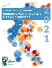
Teton Conservation District has created drinking water quality maps for nine parameters…
Excerpt from the report:
Page 6: Fluoride concentrations were available at 305 sampling locations and ranged from 0 to 20.2 mg/L, with the average of all values being 1.19 mg/L. The majority of the locations, however, had internal site average concentrations ranging from 0 to 0.6 mg/L, which is below 0.7 mg/L, the recommended concentration established to help protect against tooth decay. Eighteen sampling locations recorded higher than the 2 mg/L secondary recommended limit (nuisance standard), while nine recorded higher than the 4 mg/L EPA recommended maximum containment limit (health standard; Table 3). The majority of these locations were located in the southern portion of the county, in the vicinity of Red Top Meadows (south of Wilson) and Hoback, but some locations in and around Yellowstone also show elevated fluoride.
http://fluoridealert.org/wp-content/uploads/wy.teton-county-f-map.jan-20-2021.pdf
While isolated hot spots of nitrates plague groundwater in Jackson Hole, the pollutant doesn’t yet pose a problem in much of the valley.
Fluoride, which can yellow teeth, naturally occurs in high levels in water drawn up from wells near Munger Mountain and Red Top Meadows.
And hard water that can calcify and clog up plumbing and kill hot water heaters is pretty widespread throughout Teton County.
Those are some of the insights that can be gleaned from a new batch of maps produced over the last year and a half by the Teton Conservation District.
There’s one countywide map each for eight measures of water quality: chloride, fluoride, nitrate, pH, sodium, sulfate, total dissolved solids and total hardness.
By presenting the water quality data visually, Teton Conservation District Water Resources Specialist Carlin Girard aimed to provide residents with an easy baseline understanding of what’s in their water. The color-coded maps are accessible, but they’re also backed by hard data.
With nitrates, for example, Girard pulled in drinking water quality numbers from 140 active and defunct “public water systems” that are large enough to require monitoring from the U.S. Environmental Protection Agency. Another 220 datasets poured in from a voluntary well testing kit program that the district administers.
In total, Girard estimated that the nitrate map pulled on “something like 4,800 data points for the 360 locations.”
That type of data aggregated and displayed in a different medium could educate the public about issues that, Girard said, oftentimes are perceived as based on “subjective evidence.”
“Talking about nitrates, there are a lot of potential actions that can be created in the very near future,” he said. “Until this map was created, there’s been very little ability for people to assess this problem at a county scale.”
The exercise of creating the maps allowed Girard to take a step back to look at the valley’s drinking water more holistically. Like many others, he has been consumed by trying to address myriad water quality impairments — and had lost sight of the bright spots.
“The West Bank, especially north of Highway 22, has really fantastic water,” Girard said. “Granted, people have issues. In some cases they have fine sediment, but from a drinking water quality perspective, the north end of the West Bank has the type of water that you would hope for.”
In surface water, especially the Fish Creek watershed, there are other water pollutant issues on the West Bank related to E. coli and algae. (The maps address only drinking water.)
The Teton Conservation District intends to distribute the maps widely. The nitrate map will help with planning for wastewater infrastructure, drinking water protection and new development. On the human health side, it will go to obstetricians and pediatricians who can educate expectant patients whose fetuses and infants could be threatened by high nitrates.
Similarly, the fluoride map will be sent to Teton County’s dentists, and plumbers can even expect to see a copy of the hard water map, Girard said.
Although they provide good guidance, Girard cautioned residents to not read too far into the new water quality maps.
“There’s no substitute for testing your water,” he said. “Just because your neighbor doesn’t have a problem doesn’t mean you’re in the clear.”
A copy of the eight maps, which are bundled into a brief report, are available with this story at JHNewsAndGuide.com and at TetonConservation.org.
Teton Conservation District drinking water quality map report at http://fluoridealert.org/wp-content/uploads/wy.teton-county-f-map.jan-20-2021.pdf
*Original article online at https://www.jhnewsandguide.com/news/environmental/local/what-s-in-your-water-there-s-a-map-for-that/article_57f13643-915d-5134-ac56-b57ba0a421e0.html